The Clarens San-Traverse is a new three-day slackpacking trail that allows hikers to stride out onto the sandstone domes of the Rooiberg/Witteberg while learning about the fascinating heritage of this corner of the Eastern Free State.
Titanic Rock in the Clarens Conservancy is a monumental sandstone cliff that stands guard over the town of Clarens. As I drive past, I’m reminded yet again of the wild beauty of this part of the Eastern Free State.
Our slackpacking adventure begins
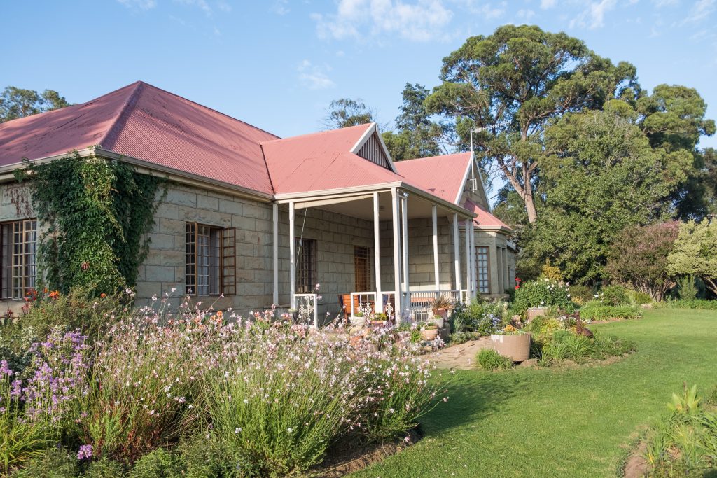
It’s a short drive out of town to St Fort Country House – the accommodation on the Clarens San-Traverse slackpack. Conceived by Julia Invernizzi of Spekboom Hiking Tours, the 41km trail will take us from St Fort through the landscapes of the Rooiberg and back to Clarens, the arty town at the foothills of those “red mountains”.
“My focus was initially on guided cycling, hiking and nature tours in the KZN Midlands, where I’m based,” says Julia as we gather for the evening braai. “But I always loved the magnificent scenery of this part of the Free State. Golden Gate Nature Reserve is nearby, with its famous Ribbok Hiking Trail, but that’s a self-guided trail where you have to carry everything and stay in basic huts en route. I saw a gap in the market: Clarens has so many comfortable guesthouses but there was no guided trail in the area. Along with Adrian Clarke from his own high berg hiking company, we explored various trail options and finally settled on an interpretative ‘amaslackpacking’ trail that combines three days of moderate hiking with visits to rock art sites and other cultural attractions.”
The Slackpacking Recce Team
The party assembled for this recce is diverse in terms of age and interests: Joining us is Julia’s sprightly 72-year-old father, Paul Colvin, one of the pioneers of slackpacking in South Africa and founder of SA Adventure Trails and Wild Coast Walks. He and Julia’s sister, Sarah Drew, who also runs hiking and adventure tours, are under strict orders to reserve judgement until the rest of the group has gone home!
Anne Price is another septuagenarian who is superhumanly active despite double hip and knee operations. When she was in her sixties she cycled 11 500km from Cairo to Cape Town, and more recently she rode from Lusaka in Zambia, through Zimbabwe to Mozambique.
But Anne is outdone on the two-wheeled adventure front by Bridget Ringdahl, an environmentalist with whom Julia works on a part-time basis. Bridget’s Blonde on a Bike books tell of her journeys through South America, India, South-East Asia, China and Tibet.
Extending the environmental lobby are Errol and Jo Douwes, who work for the eThekwini Parks and Environment Department. In their early 40s, they are using the trail as training for a trip to Mount Kenya.
There should be no shortage of conversation on this hike!
Day 1
St Fort Country House is a revamped farmhouse in the old style, with multiple en-suite rooms often leading into each other. It speaks of families with many children. The surrounding area, like much of the Eastern Free State, was once the territory of King Moshoeshoe, the founder of the Basotho nation, who was never conquered by Boer or Brit. But it was a loose kingdom. In places on the fringe, like here, another Basotho chief called Mahlomi was rumoured to head up a gang of cannibals. There are stories of Boer women having been captured by Mahlomi’s people and fattened up to be eaten. Of the cannibals themselves, there is no remaining physical relic in these mountains, which is a relief!
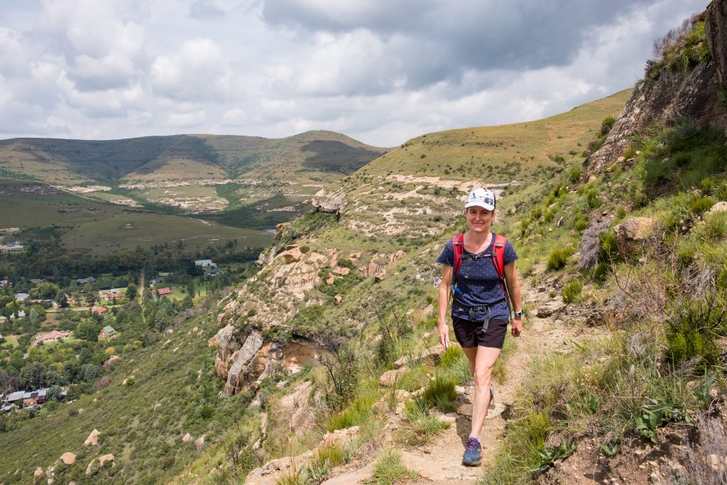
After breakfast, we hike up from the house up and onto a bald sandstone dome. Below, deep, green ravines slice through the grassland.
Our hiking guide Adrian points out pockmarks in the cliff – an extensive network of caves, some of which apparently contain Bushman paintings. But right now we’re dealing with prehistory – before Bushmen, Basotho or Boer. Two hundred million years ago, the lower layers of these big rock sheets, called Molteno sandstone, were formed. Reddish mudstone came later, and then the yellow Clarens sandstone. A top layer of black volcanic basalt capped everything off about 160 million years ago, although the basalt has since been eroded on all but the highest peaks.
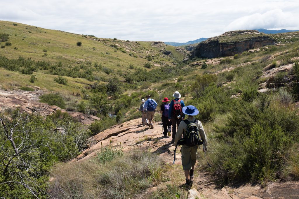
Following a wide, well-maintained hiking path, we walk between the broad domes and tunnel through the evergreen ouhout woodlands that fill the valleys between, crossing small streams as we go.
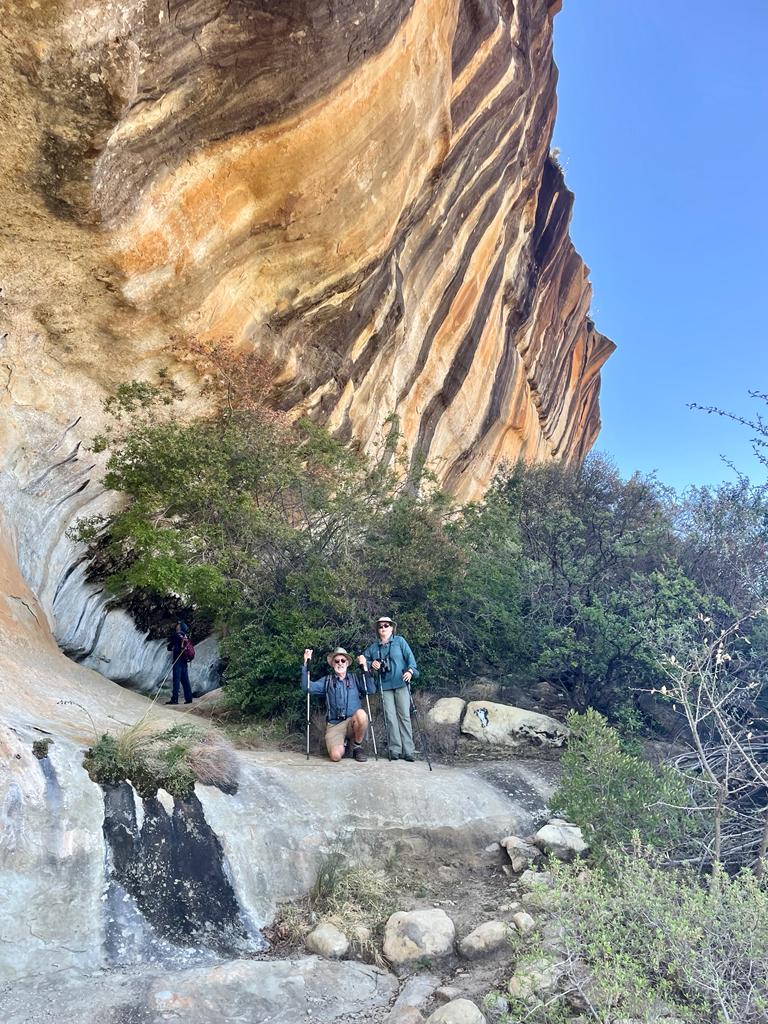
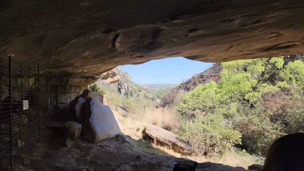
Mid-morning, a little under halfway into the day’s walk, we arrive at the first cave with Bushman paintings. It’s called St Fort 1 and it’s a large shelter with paintings clearly visible on the inner wall.
Fascinating translations of the San Paintings
Here, Adrian comes to life showing us the San Painting
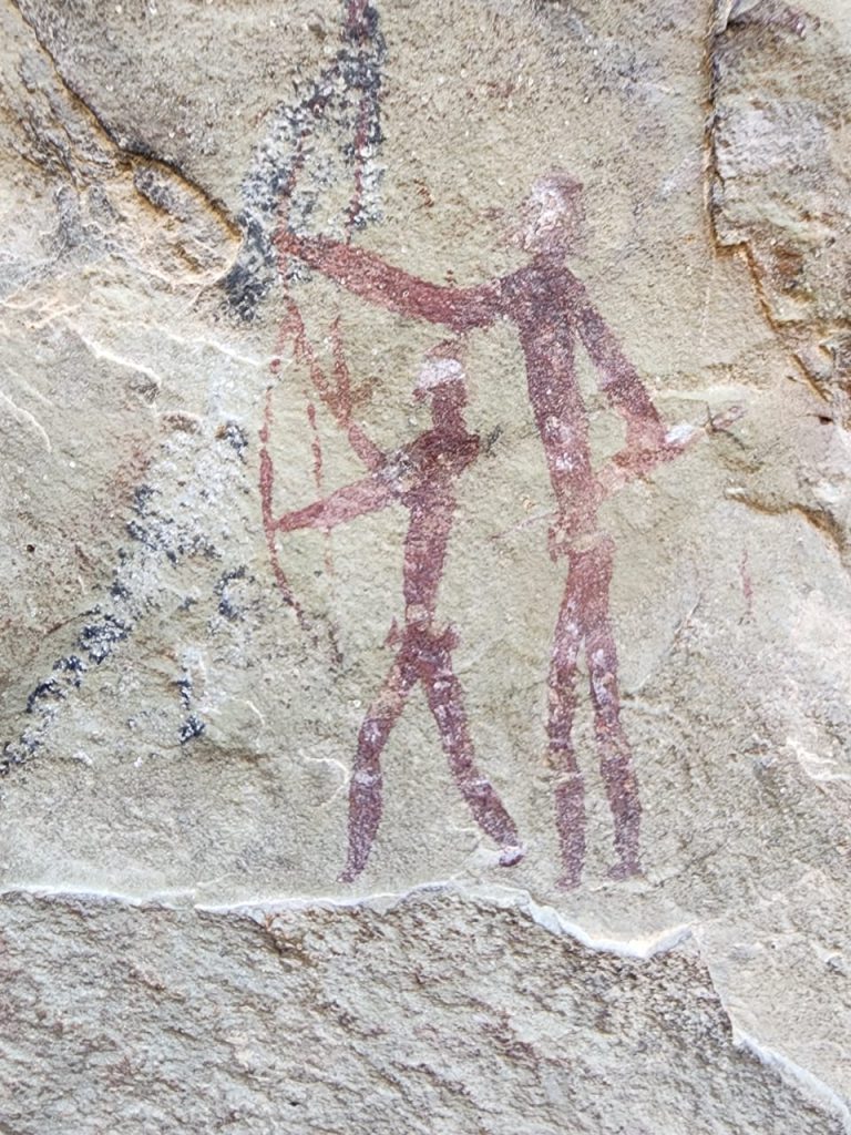
A bull eland dominates the scene but there are also several human figures with stripes and dots of body paint, representing psychic phenomena experienced during shamanic trances. Professor David Lewis-Williams, writing in the 1980s, is credited with unlocking a new understanding of Bushman paintings and other late Stone Age paintings globally: Previously, the paintings were thought to be simple records of daily life with a few “mythical” images thrown in, but Lewis-Williams came to understand them as images seen and relayed by shamans in altered states, such as those induced by a trance dance. In other words, the paintings reflect Bushman religion, just as most European art until a few centuries ago was mostly about Christianity.
Several of the human figures in the paintings are tall and carry quivers of arrows and long sticks. A white line above the figures has been interpreted as a comet.
Adrian ventures to deepen our understanding of the paintings by suggesting that certain postures indicating physical pain might symbolise psychic pain, and the experience of bursting through that pain into new levels of consciousness.
Julia, meanwhile, is more concerned that everyone has enough food for lunch!
It’s a brief walk to the second overhang, St Fort 2, which is another big shelter with a plethora of San Painting featuring individuals and small groups. Interpretation here is anybody’s guess, but Adrian fills the gap with confident analysis. One figure has an elongated snout that appears to be a mask, but also a pair of paws, again apparently depicting hallucinatory images. It and another figure are partially obscured by the image of an eland, indicating overpainting at later times.
Julia tells us how eland and other antelope are still seen in the area, along with mammals like jackal, porcupine, serval, dassies and mongoose. Her enthusiasm for the fauna and flora complements Adrian’s intimate knowledge of psychedelics and his wacky style of delivery. They make a good team and provoke animated discussion within the group.
Leaving the cave, a Verreauxs’ eagle soars above. Humans are not solely responsible for this bird’s endangered status. Julia says that the eagles practise Cainism: If the first offspring is healthy, it and the mother peck the second-born to death. Take your pick between Cainism and cannibalism. In South Africa, you just accept your good fortune at being alive!
Later that afternoon we walk off the sandstone domes through a valley to Skaaplaas farm, startling some zebra and blesbok in the grasslands. Once past the owner’s house, it’s a 1,5km walk along a farm road lined with red hot pokers and cosmos to our overnight stop. Unlike the caves, St Fort has comfortable rooms and a beautiful view toward Clarens and the mountains.
Once settled in, Adrian tells us the story of nearby Surrender Hill, a long, flat-topped mountain where 4 314 Boers surrendered to the British on 31 July 1900.
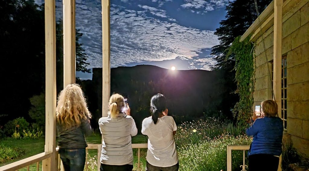
After tea and rusks, most of us retire for an afternoon nap. One of the joys of slackpacking is a comfy bed and someone else doing the cooking and chores! Dinner is a traditional meal of roast lamb, veggies and bread pudding; afterwards we sit outside with a nightcap and look at the stars.
DAY 2: 14KM
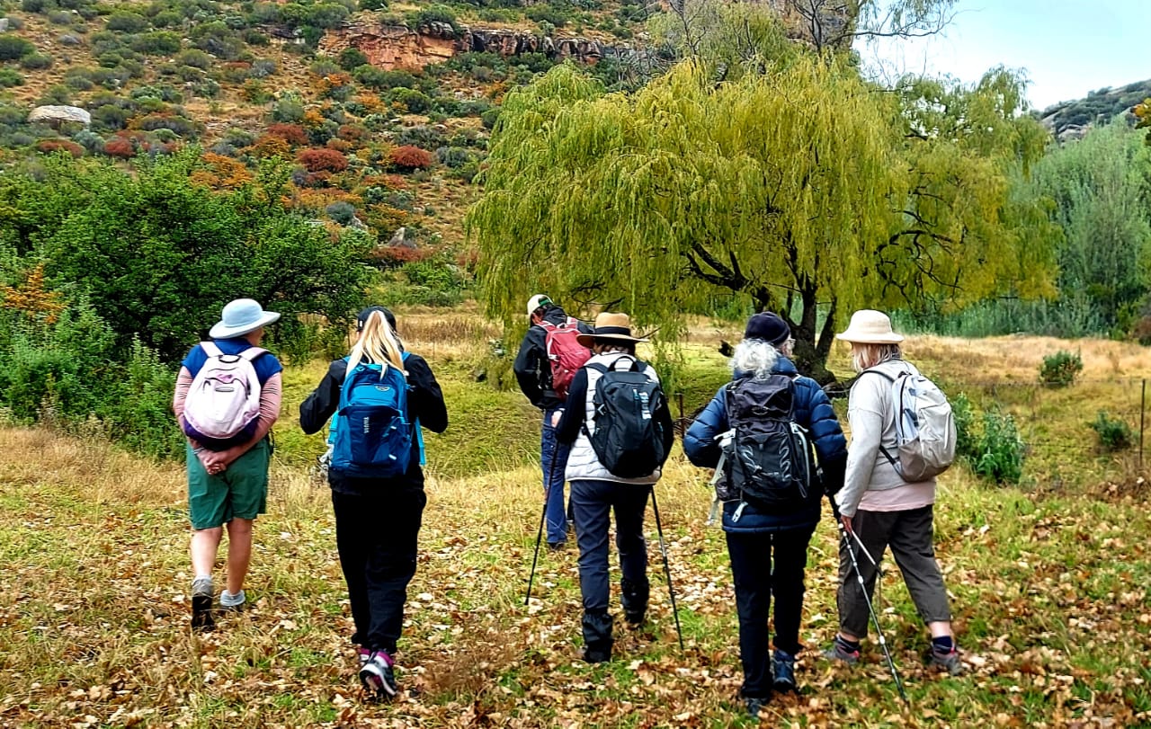
An hour and a half’s walk up through beautiful farmland and past knuckled willow trees brings us to Schaapplaats Cave, where a barbed-wire fence protects the San paintings from over-curious or destructive visitors.
During Adrian’s 20 years in Clarens, these paintings have degraded: “They went unharmed for thousands of years but now they are disappearing because of vandalism,” he laments.
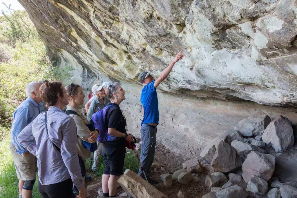
There are two main groups of paintings in this cave, which is smaller and darker than the previous sites. Particularly prominent are figures with animal heads, called therianthropes, which are explained as the fusion of animal and human when a shaman enters a trance. There are also two bulbous-looking creatures – rain animals – representing the Bushman concept that a spirit animal lives in the thunderclouds.
From the cave, we climb steeply for three hours along a ridgeline to George’s Pimple (2 500m), a distinctive peak in the high basalt layer that resembles a Basotho hat. Stopping for lunch on route, we take in the spectacular views of Lesotho and the Caledon River – Moshoeshoe’s country.
From there it’s a gradual descent to the base of the peak where we are shuttled back. It’s a glorious evening at the guesthouse: The air is clean and fresh; the only noise is birdsong. We sip sundowners and watch the surrounding hills glow in the golden light that makes the Eastern Free State hiking so special. It’s no wonder so many painters are drawn to this part of the world.
Day 3: The history of Clarens
In the morning, we drive for 10 minutes to Clarens and park our cars so that we can head home after the day’s activities.
Today’s tour starts with a history lesson at a memorial erected for five Boers who were killed in a long-forgotten skirmish at Naauwpoortnek. That event prompted the Third Boer-Basotho War of 1865, when Moshoeshoe was already an old man.
Founded in 1912, Clarens is named after the mountain hamlet in Switzerland where another old man passed away in exile aged 78. Paul Kruger was president of the Transvaal Republic during the second Anglo-Boer War and he’d travelled to Europe to garner support for the Boers as the tide turned against them in the war. He refused to return home after British victory and died of pneumonia overlooking Lake Geneva.
An easy drive from Joburg or Pretoria, Bloemfontein or Durban, Clarens is an attractive town with an abundance of art galleries, craft shops, bars and restaurants. We plan to work up an appetite before such spoils, so we head towards the well-marked trails of Clarens Nature Reserve.

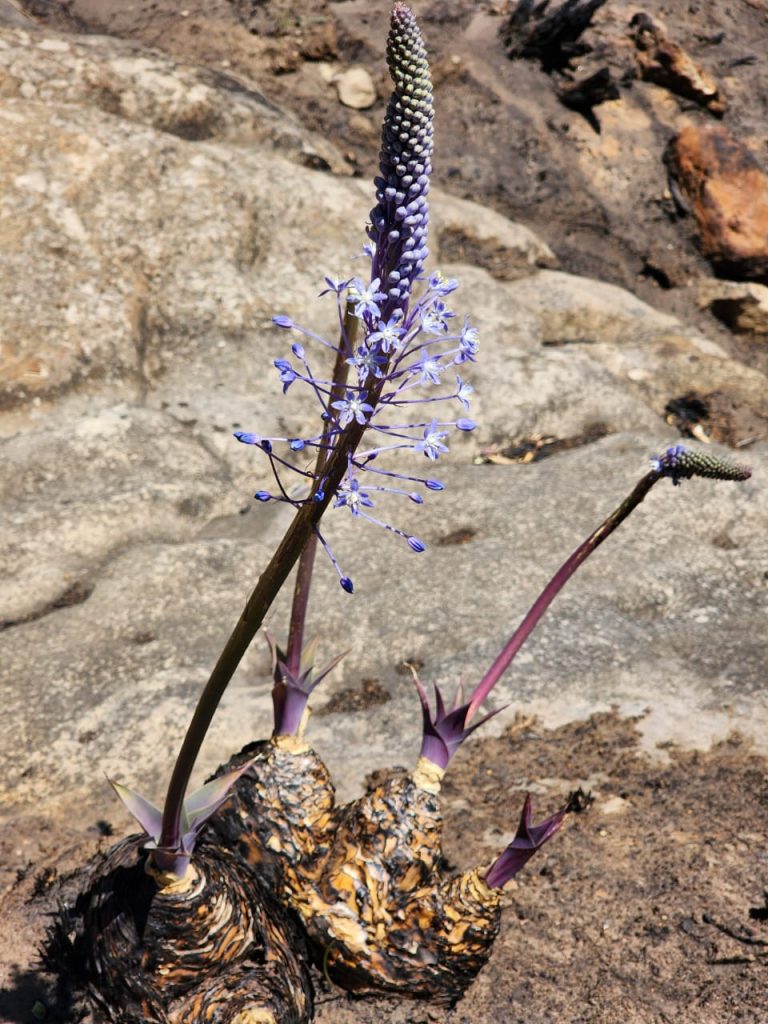
Our route takes us past many of the town’s grand sandstone buildings, including the beautiful Dutch Reformed church, which was built in 1940. From there, we walk along the town’s easy Spruit Trail, a gentle stroll in the shade of Lombardy poplars, cedars and ouhout trees that follows a mountain stream to Kloof Dam. Adrian quietly forages some Boletus mushrooms for his dinner (known as porcini elsewhere in the world) while Julia points out floral treasures such as red hot pokers, yellow everlastings, crassulas, aristeas, lobelias and Wahlenbergia.
The Spruit Trail feeds into the Clarens Mountain Trail, which we ascend for about half an hour to a high point where we pause to take in the view of the town, Titanic Rock, Naauwpoortnek and Mount Horeb, named after the mountain in the Sinai Desert where God supposedly gave Moses the Ten Commandments.
At the end of the 10km circular trail we roll into town and slake our thirst with some Red Stone craft gin at the Clarens Brewery. As we raise our glasses, we’re all in agreement: The Clarens San-Traverse slackpack has been a fascinating journey of discovery.
If you would like experience this slackpack tour check out our 3 day, 3 night Clarens slackpackpack